Links to other parts of this web site:
Links to outside web sites:New Mexico Department of Tourism
Camping, back roads and trains
Dan and Dawn's New Mexico Adventures
Or, "Sure we can make it through here without getting stuck".
New Mexico is interesting to train buffs because of the antiquated semaphore signals used to control train movements, as well as the state's interesting history and scenery. These semaphore signals are some of the last in operation on a mainline railroad in the country. In 2002 the freight railroad was preparing to replace they with modern signals. My husband Dan and I, Dawn, decided to see and photograph them in May and August of 2002.
We also took the opportunity to explore a remote area that involved crossing a dry river bed and traveling on a primitive road, while following the railroad.
I'll start my story in Raton, NM. Raton is just south of the Colorado border, and is the last major town on the railroad before the semaphores. It is just south of Raton Pass, where the railroad has to go through a tunnel to handle the steep grade. Raton has an Amtrak station, and is built below some mountains. The mountain overlooking the town isn't very tall, but tall enough to give one a good view from the scenic overlook at the top.
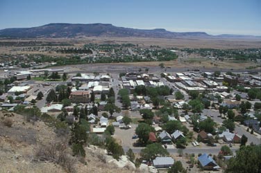
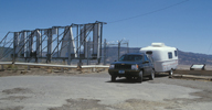
This is the view from the scenic overlook. You can see the edge of the hill we're on at the bottom left of the larger photo. We stopped for photos, to eat a snack and to watch Amtrak's 'Southwest Chief' come into town. They came in from the left (south), and stopped for about five minutes at the train station. The railroad tracks are the gray strip past the large buildings but before the trees start again in the distance.
 In the small photo the word 'Raton' is spelled out in large white letters with lights on them. To the right out of the photo there is a large metal star with lights on it. The whole display must be quite a sight when it's all lit up at night.
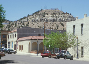
The photo on the left is what it looks like from downtown Raton. The road to the scenic overlook was part of the old road out of town--up and over the mountains. Now the freeway goes around the hills, instead of going over the top of them.
Back to the top
Now for the semaphores.
In 2002 they were on the rail line from Raton south to Albuquerque. Amtrak ran (and as of May 2005 currently runs) on this line, so it is possible to see modern diesel locomotives run past ~80 year old signals. The BNSF railroad owns and maintains the line. At the time we saw it, there were not many freight trains using the line, so we knew that we could count on seeing at least two passenger trains a day. We found this to be very helpful.
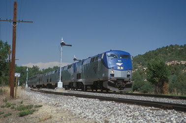
This is a view of Amtrak's 'Southwest Chief' passing the semaphores in Watrous, NM. in May 2002. Watrous is about 50 miles south of the first semaphores.
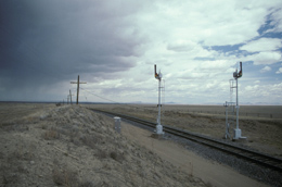
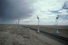
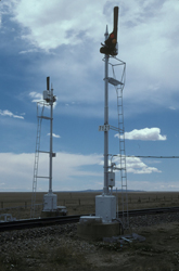
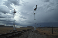
Here are some of the signals just south of Raton. When we visited in May of 2002 a storm blew through. It didn't last for more than about an hour, but it poured like crazy and was a bit windy. It actually does rain in the desert! In the background on some of them you can see a storm was rolling in. In the lower right photo the freeway and a frontage road run parallel to the railroad along at the far right.
|
|
|
Back to the top
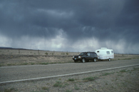
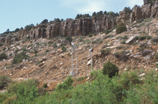
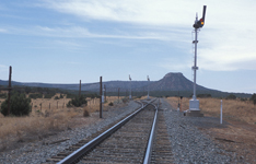
We traveled the highway frontage road when we photographed the semaphores. We pulled into a side road off of it to eat lunch and sit out the storm. It was awesome to watch the clouds roll in. The weather cleared up a bit by the time we got to the hilly and green area near Watrous.

|
|
|
Trains go through some remote country in the area between Watrous and Las Vegas, NM. Yes, there is a Las Vegas in New Mexico. We were only able to follow the railroad part of the way between the two towns. We saw an Amtrak train running on the railroad line near a horse pasture at Rancho Valmora. There happens to be a detention center for boys there, and these were their horses. The horses wandered out of view by the time the train came by.
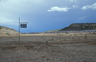
|
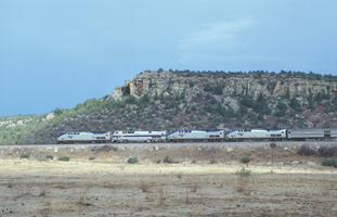
|
Back to the top
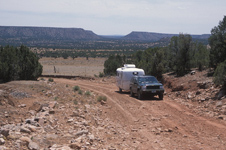
We spent the night at the KOA campground in Las Vegas, NM. The KOA staff claim it is on what was a part of the old Highway Route 66. We decided to look for semaphores on the rail line south of Las Vegas by using a back road. It got to be very rough and rocky in spots, but we had no trouble getting through.
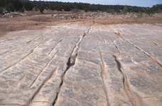
At the beginning of this road there were some farms, but they dwindled away until it was just range land. We then came to a dry river bed, where the road crossed next to the railroad bridge. Dan tells me it's Tecolote Creek. In a wet year a trip this way would have ended at the river bed, but since it was dry, we could get through. The river bed was hard, polished rock with cracks running all through it.
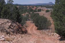
|
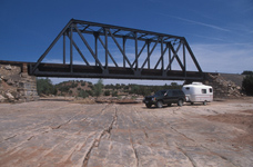
|
|
|
We continued on, and passed under the railroad tracks by going through a cement tunnel. The road condition got to the point where I had to get out of the Jeep and direct Dan around some rocks and holes in the road, but then the road got a lot better. I remember it being a very windy day. Go to Dan's web site at: Scamp Travel Trailer Excursions and look for the link: 'New Mexico May, 2002' for his views of the trip.
We found a nice spot to eat lunch, and then found the main local road to the small town of Chapelle, NM. It is there that we saw the eastbound and westbound Amtrak trains meet each other, and saw more semaphores.
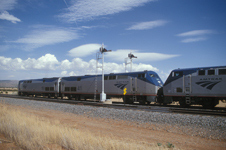
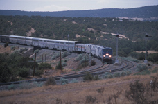
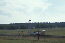
This Amtrak train had to stop on the curve, and one of the crew had to get out and throw the switch for the track. The train had to go onto the siding so the train going the other direction could go by them. A short time later the other Amtrak train came by. We then made our way to the freeway, and to the KOA campground in Sante Fe, NM.
Back to the top
On our August visit we saw a signal maintainer working on one of the semaphore sets. It's my understanding that semaphores are higher maintenance than newer signals. They are also now non-standard. These two factors encourage the railroads to replace them. There were obvious signs of eminent replacement in the area just south of Raton, especially on our August visit.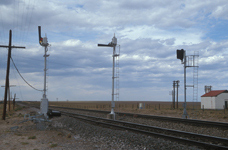
In this photo, the new 'tri-light' signal is already up, but facing away from the track on the right side. I don't know when the change-over was made, but it probably happened in late 2002 or early 2003. I'm glad we made the effort to see and photograph these antiques, before the opportunity disappeared. Follow the links for more of our 'Hit the Road' adventures.
Back to the top Back to the Home page Arizona Colorado Northern Minnesota
Comments? Please me e-mail at: wx0z[at]skypoint.com. I would love to hear what you think about this web site.
'Hit the Road' in MC AUTO font ©2002 by Brian Stuparyk. See http://chank.com for more information.
This page and all its contents ©2005 by Dawn Holmberg